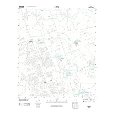
2010 Map of Leander
USGS Topo · Published 2010About this map
Leander and Cedar Park anchor this residential and suburban landscape as it appeared in the first decade of the 21st century. The map reveals a complex network of water management features, specifically a series of numbered Soil Conservation Service reservoirs and dams that follow the paths of Brushy Creek and its many tributaries, including Spanish Oak Creek and Block House Creek. This hydrological engineering underscores the suburban development patterns pushing into the hill country north of Austin.
Find a feature on this map
86 named features on this map. Tap any name to fly to it.
Don’t see what you’re looking for? This feature index may not catch every label — zoom into the map to look around manually.
Map Details
Editions of this 2010 Leander Map
This is the sole edition of this map. No revisions or reprints were ever made.
Other maps of this area

1893 · Georgetown
USGS Topo · 1:125,000

1896 · Austin
USGS Topo · 1:125,000

1897 · Austin
USGS Topo · 1:125,000

1910 · Austin
USGS Topo · 1:125,000

1925 · Georgetown 4-b
USGS Topo · 1:48,000

1928 · Round Rock
USGS Topo · 1:62,500

1930 · Austin-2
USGS Topo · 1:48,000

1932 · Mt. Bonnell
USGS Topo · 1:62,500

1949 · Round Rock
USGS Topo · 1:62,500

1951 · Round Rock
USGS Topo · 1:62,500