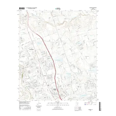
2016 Map of Leander
USGS Topo · Published 2016About this map
Leander and Cedar Park anchor this survey of the rapidly developing corridor along the Travis and Williamson County line. The landscape is defined by the headwaters of the San Gabriel and Brushy Creek systems, where numerous water management features like Soil Conservation Service Site 3 Reservoir and Soil Conservation Service Site 5 Reservoir illustrate modern flood control efforts. For local historians, the presence of several small burial grounds such as Upchurch Cem, Bagdad Cem, and Whitley Cem provides critical genealogical touchpoints in an area seeing significant residential growth. The transition from rural ranching to suburban expansion is evident in the dense street networks pressing against established landmarks like Breakaway Park Airport and the historic named locales of Walkerton and White Stone.
Find a feature on this map
334 named features on this map. Tap any name to fly to it.
Don’t see what you’re looking for? This feature index may not catch every label — zoom into the map to look around manually.
Map Details
Editions of this 2016 Leander Map
This is the sole edition of this map. No revisions or reprints were ever made.
Other maps of this area

1893 · Georgetown
USGS Topo · 1:125,000

1896 · Austin
USGS Topo · 1:125,000

1897 · Austin
USGS Topo · 1:125,000

1910 · Austin
USGS Topo · 1:125,000

1925 · Georgetown 4-b
USGS Topo · 1:48,000

1928 · Round Rock
USGS Topo · 1:62,500

1930 · Austin-2
USGS Topo · 1:48,000

1932 · Mt. Bonnell
USGS Topo · 1:62,500

1949 · Round Rock
USGS Topo · 1:62,500

1951 · Round Rock
USGS Topo · 1:62,500