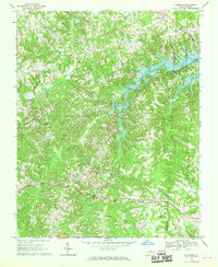
1968 Map of Leasburg
USGS Topo · Published 1970About this map
Hyco Lake dominates the central landscape of this Caswell County region, its finger-like branches reaching into the surrounding Piedmont terrain. The lake's formation significantly altered the local geography, creating a new shoreline that borders the settlements of Semora and Osmond. This 1968 survey documents a dense network of rural community centers, particularly identified by an extensive list of country churches including Gilead Ch, Shiloh Ch, and New Hope Ch.
Find a feature on this map
39 named features on this map. Tap any name to fly to it.
Don’t see what you’re looking for? This feature index may not catch every label — zoom into the map to look around manually.
Map Details
Editions of this 1968 Leasburg Map
3 editions found
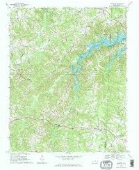
Other maps of this area

1923 · Danville
USGS Topo · 1:48,000

1925 · Danville
USGS Topo · 1:62,500

1952 · Milton
USGS Topo · 1:62,500

1953 · Greensboro
USGS Topo · 1:250,000

1954 · Greensboro
USGS Topo · 1:250,000

1956 · Milton
USGS Topo · 1:62,500

1962 · Greensboro
USGS Topo · 1:250,000

1965 · Ringgold
USGS Topo · 1:24,000

1966 · Greensboro
USGS Topo · 1:250,000

1968 · Leasburg
USGS Topo · 1:24,000