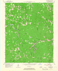
1954 Map of Leatherwood
USGS Topo · Published 1967About this map
Leatherwood serves as a primary hub for this mid-century look at the Kentucky mountains, situated at the junction where the Louisville and Nashville railroad follows the winding path of Clover Fork. The map documents a rugged landscape defined by a dense network of mountain schools and small creeks, reflecting the localized settlement patterns of the 1950s. Educational outposts like Livingston Sch, Big Rock Sch, and Stratton Sch are scattered throughout the hollows, illustrating the community structure before modern consolidation. To the west, the community of Yeaddiss sits along the banks of Cutshin Creek, surrounded by family-named landmarks and geographic features such as Big Rock. The complex system of waterways, including Laurel Fork and Persimmon Fork, dictates the orientation of local roads like KY 699, which trace the narrow valley floors between steep ridgelines.
Find a feature on this map
76 named features on this map. Tap any name to fly to it.
Don’t see what you’re looking for? This feature index may not catch every label — zoom into the map to look around manually.
Map Details
Editions of this 1954 Leatherwood Map
2 editions found
Other maps of this area

1887 · Jonesville
USGS Topo · 1:125,000

1891 · Hazard
USGS Topo · 1:125,000

1891 · Jonesville
USGS Topo · 1:125,000

1903 · Harlan
USGS Topo · 1:48,000

1916 · Cornettsville
USGS Topo · 1:62,500

1916 · Harlan
USGS Topo · 1:48,000

1916 · Nolansburg
USGS Topo · 1:48,000

1916 · Hyden
USGS Topo · 1:48,000

1919 · Nolansburg
USGS Topo · 1:62,500

1919 · Hyden
USGS Topo · 1:62,500