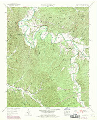
1951 Map of Leatherwood
USGS Topo · Published 1970About this map
The Buffalo River snakes through the borderlands of Perry and Wayne County, defining a landscape of deep hollows and sharp ridges as it appeared mid-century. This territory is characterized by its isolated settlements and small community centers like Flat Woods and Leatherwood. The river’s winding course includes dramatic features such as Whitaker Bend, Bastin Bend, and Horseshoe Bend, with the gaging station at Mile 59 monitoring the waterway's flow.
Find a feature on this map
86 named features on this map. Tap any name to fly to it.
Don’t see what you’re looking for? This feature index may not catch every label — zoom into the map to look around manually.
Map Details
Editions of this 1951 Leatherwood Map
3 editions found
Other maps of this area

1905 · Waynesboro
USGS Topo · 1:125,000

1936 · Graves Spring
USGS Topo · 1:24,000

1936 · Eagle Creek
USGS Topo · 1:24,000

1936 · Linden
USGS Topo · 1:24,000

1936 · Leatherwood
USGS Topo · 1:24,000

1936 · Negro Hollow
USGS Topo · 1:24,000

1936 · Clifton
USGS Topo · 1:24,000

1936 · Waynesboro
USGS Topo · 1:24,000

1936 · Topsy
USGS Topo · 1:24,000

1936 · Pope
USGS Topo · 1:24,000