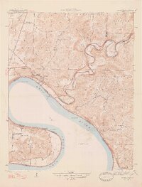
1947 Map of Leavenworth
USGS Topo · Published 1947About this map
Leavenworth and its position along the Ohio River dominate this mid-century survey of the Indiana-Kentucky border. The landscape is defined by the winding course of the Blue River as it meets the Ohio, carving through high points like Greenbrier Knob and Scott Hill. This 1940s mapping provides a clear view of the rural infrastructure of Crawford County and Harrison County, noting essential community centers such as Sunshine Sch and the Potato Run Ch.
Find a feature on this map
35 named features on this map. Tap any name to fly to it.
Don’t see what you’re looking for? This feature index may not catch every label — zoom into the map to look around manually.
Map Details
Editions of this 1947 Leavenworth Map
2 editions found
Other maps of this area

1931 · Corydon
USGS Topo · 1:62,500

1944 · Corydon West
USGS Topo · 1:24,000

1946 · Leavenworth
USGS Topo · 1:24,000

1946 · Depauw
USGS Topo · 1:24,000

1947 · Leavenworth
USGS Topo · 1:24,000

1947 · Corydon West
USGS Topo · 1:24,000

1947 · Mauckport
USGS Topo · 1:24,000

1948 · Milltown
USGS Topo · 1:24,000

1950 · Beechwood
USGS Topo · 1:24,000

1950 · English
USGS Topo · 1:24,000