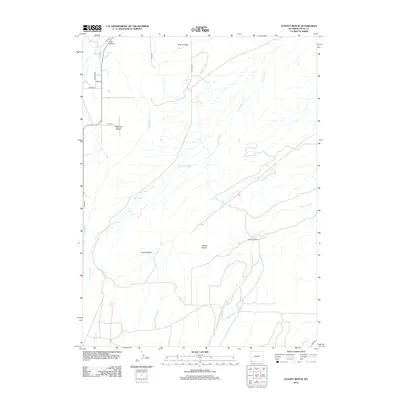
2012 Map of Leavitt Bench
USGS Topo · Published 2012About this map
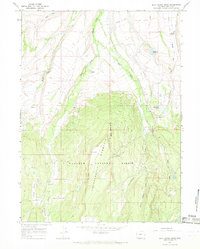
Tipperary Bench and Leavitt Bench dominate this high-plains landscape of Uinta County, where the topography is defined by broad flat-topped mesas and the drainages that carve between them. The agricultural character of the region is evident in the managed water systems, including the Milich Ditch and natural sources like Pitcher Spring and Corral Spring. These water features support the Slagowski Ranch, a primary point of human settlement in a terrain otherwise characterized by open expanses like Poverty Flats and Leavitt Basin. A network of county roads, such as Tipperary Rd and Uinta Dr, connects these isolated homesteads and grazing lands. The hydrology is centered on seasonal and perennial flows including Cottonwood Cr, Leavitt Cr, and Little Dry Cr, which together shape the erosion patterns of this western Wyoming landscape.
Find a feature on this map
22 named features on this map. Tap any name to fly to it.
Don’t see what you’re looking for? This feature index may not catch every label — zoom into the map to look around manually.
Map Details
Editions of this 2012 Leavitt Bench Map
This is the sole edition of this map. No revisions or reprints were ever made.
Other maps of this area

1954 · Ogden
USGS Topo · 1:250,000

1958 · Ogden
USGS Topo · 1:250,000

1960 · Ogden
USGS Topo · 1:250,000

1964 · Reed Reservoir
USGS Topo · 1:24,000

1964 · Fort Bridger
USGS Topo · 1:24,000

1964 · Mountain View
USGS Topo · 1:24,000
1964 · Lonetree
USGS Topo · 1:24,000
1964 · Table Mountain
USGS Topo · 1:24,000
1964 · Leavitt Bench
USGS Topo · 1:24,000
1964 · Buck Fever Ridge
USGS Topo · 1:24,000