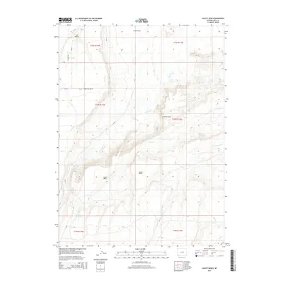
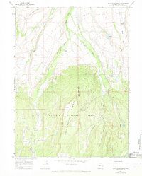
2015 Map of Leavitt Bench
USGS Topo · Published 2015About this map
Leavitt Bench and the surrounding high plains of Uinta County define this landscape of water management and livestock grazing. The intricate engineering of the Milich Ditch cuts across the western portion of the map, illustrating the vital role of irrigation in the arid terrain south of Poverty Flats. The topography is dominated by dramatic elevation changes where Tipperary Bench drops away into Leavitt Basin, a region carved by seasonal drainages such as Leavitt Cr and Little Dry Cr. These water sources, alongside reliable points like Pitcher Spring and Corral Spring, represent the essential infrastructure for ranching operations in this corner of Wyoming. While the area remains largely open range, the network of county roads including Tipperary Rd and WY-410 connects these disparate pastures and canyons.
Find a feature on this map
28 named features on this map. Tap any name to fly to it.
Don’t see what you’re looking for? This feature index may not catch every label — zoom into the map to look around manually.
Map Details
Editions of this 2015 Leavitt Bench Map
This is the sole edition of this map. No revisions or reprints were ever made.
Other maps of this area

1954 · Ogden
USGS Topo · 1:250,000

1958 · Ogden
USGS Topo · 1:250,000

1960 · Ogden
USGS Topo · 1:250,000

1964 · Reed Reservoir
USGS Topo · 1:24,000

1964 · Fort Bridger
USGS Topo · 1:24,000

1964 · Mountain View
USGS Topo · 1:24,000
1964 · Lonetree
USGS Topo · 1:24,000
1964 · Table Mountain
USGS Topo · 1:24,000
1964 · Leavitt Bench
USGS Topo · 1:24,000
1964 · Buck Fever Ridge
USGS Topo · 1:24,000