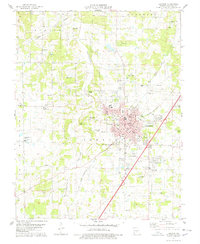
1978 Map of Lebanon
USGS Topo · Published 1978About this map
Lebanon serves as the focal point of this mid-1970s survey, showing the community at a time of significant growth along the St Louis - San Francisco rail line. The town's infrastructure is well-defined, from the Courthouse and Po at its center to the Floyd W Jones Lebanon Airport on the southern edge. The map captures the suburban expansion into West Lebanon and Southern Heights, balanced by a landscape of karst features like Adkins Sink and the distinctive creek beds of Goodwin Hollow. Family names and local history are preserved through several rural burial grounds such as Atchley Cem and Donald Cem, while community life is anchored by institutions like the Maplecrest Sch and the Lebanon Country Club.
Find a feature on this map
63 named features on this map. Tap any name to fly to it.
Don’t see what you’re looking for? This feature index may not catch every label — zoom into the map to look around manually.
Map Details
Editions of this 1978 Lebanon Map
This is the sole edition of this map. No revisions or reprints were ever made.
Other maps of this area

1933 · Stoutland
USGS Topo · 1:62,500

1934 · Macks Creek
USGS Topo · 1:48,000

1938 · Stoutland
USGS Topo · 1:62,500

1939 · Macks Creek
USGS Topo · 1:62,500

1939 · Long Lane
USGS Topo · 1:62,500

1941 · Lebanon
USGS Topo · 1:62,500

1942 · Long Lane
USGS Topo · 1:62,500

1943 · Lebanon
USGS Topo · 1:62,500

1954 · Springfield
USGS Topo · 1:250,000

1958 · Springfield
USGS Topo · 1:250,000