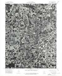
1975 Map of Lebanon NW
USGS Topo · Published 1976About this map
Lebanon serves as the focal point of this 1975 orthophotograph, showing the town's mid-century expansion into the Missouri countryside. Unlike a traditional line-and-symbol map, this aerial survey provides a photographic record of the land as it appeared during the spring of that year, revealing the precise density of residential streets, industrial structures, and the patchwork of active farmland surrounding the community center. The prominent drainage of Goodwin Hollow winds through the western portion of the quadrangle, carving a distinct corridor through the landscape. This orthophoto, produced by the United States Geological Survey in cooperation with the Missouri Department of Natural Resources, preserves the literal footprint of Laclede County's development, from the highway intersections in town to the specific layout of rural farmsteads and field boundaries.
Find a feature on this map
2 named features on this map. Tap any name to fly to it.
Don’t see what you’re looking for? This feature index may not catch every label — zoom into the map to look around manually.
Map Details
Editions of this 1975 Lebanon NW Map
This is the sole edition of this map. No revisions or reprints were ever made.
Other maps of this area

1933 · Stoutland
USGS Topo · 1:62,500

1934 · Macks Creek
USGS Topo · 1:48,000

1938 · Stoutland
USGS Topo · 1:62,500

1939 · Macks Creek
USGS Topo · 1:62,500

1939 · Long Lane
USGS Topo · 1:62,500

1941 · Lebanon
USGS Topo · 1:62,500

1942 · Long Lane
USGS Topo · 1:62,500

1943 · Lebanon
USGS Topo · 1:62,500

1954 · Springfield
USGS Topo · 1:250,000

1958 · Springfield
USGS Topo · 1:250,000