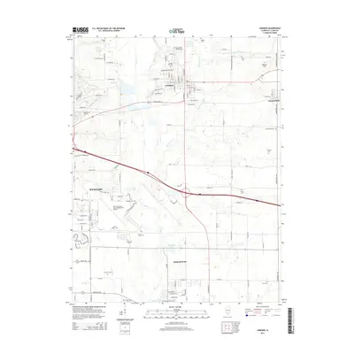
2015 Map of Lebanon
USGS Topo · Published 2015About this map
McKendree University serves as a prominent landmark in the settlement of Lebanon, where residential streets meet the agricultural expanses of Saint Clair County. This region is characterized by a high concentration of burial grounds, including College Hill Cem and Saint Joseph Catholic Cem, which offer significant value for genealogical research. The landscape is defined by the drainage of Silver Cr and Little Silver Cr, which flow through a mix of farmland and growing residential developments. To the southwest, the expansive grounds of Scott Air Force Base/MidAmerica Airport dominate the local geography, representing a major military and transportation hub. The smaller settlements of Summerfield and the northern edge of Mascoutah are also documented, connected by a network of rural roads such as Pister Rd and Rieder Rd.
Find a feature on this map
75 named features on this map. Tap any name to fly to it.
Don’t see what you’re looking for? This feature index may not catch every label — zoom into the map to look around manually.
Map Details
Editions of this 2015 Lebanon Map
This is the sole edition of this map. No revisions or reprints were ever made.
Other maps of this area

1906 · Breese
USGS Topo · 1:62,500

1907 · Breese
USGS Topo · 1:62,500

1907 · Belleville
USGS Topo · 1:62,500

1910 · Okawville
USGS Topo · 1:62,500

1912 · New Athens
USGS Topo · 1:62,500

1935 · Lebanon
USGS Topo · 1:24,000

1937 · Collinsville
USGS Topo · 1:24,000

1937 · O'Fallon
USGS Topo · 1:24,000

1940 · Okawville
USGS Topo · 1:62,500

1949 · Lebanon
USGS Topo · 1:24,000