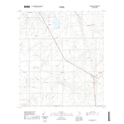
2021 Map of Lebanon Station
USGS Topo · Published 2021About this map
Lebanon Station serves as a primary point of reference in this coastal lowland region of Levy County, where the landscape is defined by an intricate network of waterways and sloughs. The Waccasassa River and Wekiva River flow through the northwest, while the southeastern corner is marked by the Goethe State Forest Trl near the intersection of major transit routes. The settlement of Gulf Hammock and the historic Beetree Ford reflect a pattern of rural habitation tightly integrated with the wetlands. Notable local landmarks include the Mount Erie Cem and numerous named drainages such as Bullfrog Creek and Tenmile Creek. The dominance of sloughs like Porter Slough and Sand Slough underscores the hydrological complexity of this area, highlighting how local geography has historically dictated the placement of roads and small communities.
Find a feature on this map
77 named features on this map. Tap any name to fly to it.
Don’t see what you’re looking for? This feature index may not catch every label — zoom into the map to look around manually.
Map Details
Editions of this 2021 Lebanon Station Map
This is the sole edition of this map. No revisions or reprints were ever made.
Other maps of this area

1954 · Yankeetown SE
USGS Topo · 1:24,000

1954 · Otter Creek
USGS Topo · 1:24,000

1954 · Bronson SW
USGS Topo · 1:24,000

1954 · Gainesville
USGS Topo · 1:250,000

1955 · Lebanon Station
USGS Topo · 1:24,000

1955 · Withlacoochee Bay
USGS Topo · 1:24,000

1955 · Waccasassa Bay
USGS Topo · 1:24,000

1955 · Yankeetown
USGS Topo · 1:24,000

1955 · Tidewater
USGS Topo · 1:24,000

1955 · Bronson SE
USGS Topo · 1:24,000