
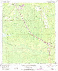
1955 Map of Lebanon Station
USGS Topo · Published 1956About this map
Gulf Hammock dominates the landscape of western Levy County in the mid-1950s, characterized by a dense network of sloughs and creeks that once supported a thriving river-and-rail timber economy. The Atlantic Coast Line railroad cuts a straight path southeast toward Lebanon Station, which serves as a small focal point near a Quarry and the Lebanon Lookout Tower. Along the western edge near the Waccasassa River, several landings such as Gunn Landing and Old Plantation Landing point to the historic importance of water-based transport in this wetland environment. Social life in the more elevated interior is anchored by Mt Moriah Ch and Mt Erie Ch, while an Old Railroad Grade and the Bee Tree Ford on Cow Creek reveal earlier routes through the dense hammock and cypress drains.
Find a feature on this map
28 named features on this map. Tap any name to fly to it.
Don’t see what you’re looking for? This feature index may not catch every label — zoom into the map to look around manually.
Map Details
Editions of this 1955 Lebanon Station Map
3 editions found
Other maps of this area

1954 · Yankeetown SE
USGS Topo · 1:24,000

1954 · Otter Creek
USGS Topo · 1:24,000

1954 · Bronson SW
USGS Topo · 1:24,000

1954 · Gainesville
USGS Topo · 1:250,000

1955 · Withlacoochee Bay
USGS Topo · 1:24,000

1955 · Waccasassa Bay
USGS Topo · 1:24,000

1955 · Yankeetown
USGS Topo · 1:24,000

1955 · Tidewater
USGS Topo · 1:24,000

1955 · Bronson SE
USGS Topo · 1:24,000
1957 · Bronson SE
USGS Topo · 1:25,000