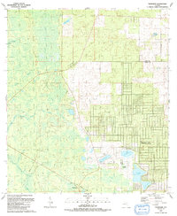
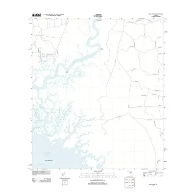
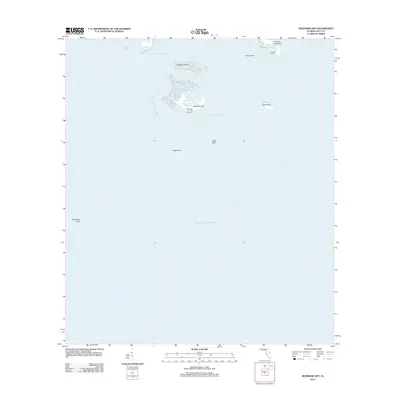
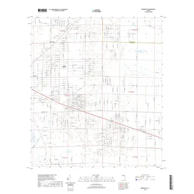
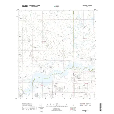
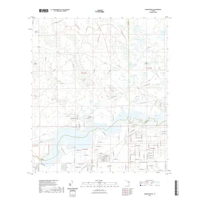
1957 Map of Bronson SE
USGS Topo · Published 1957About this map
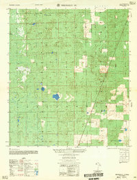
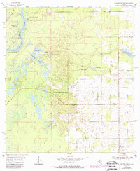
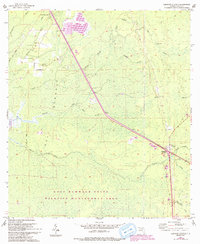
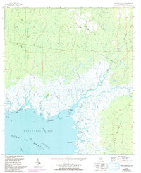
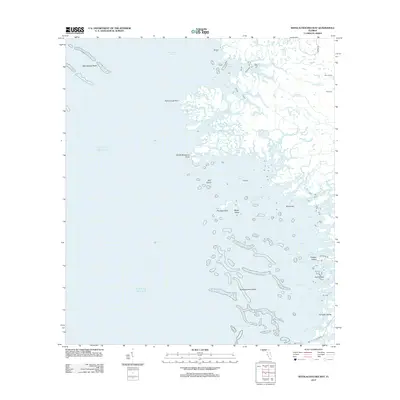
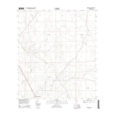
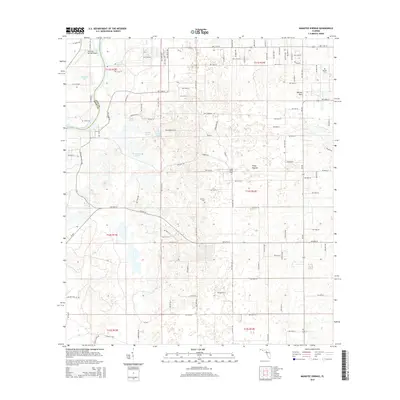
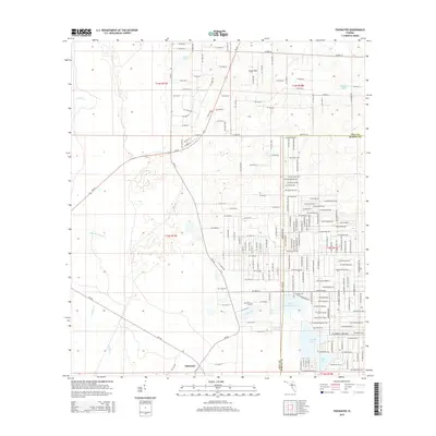
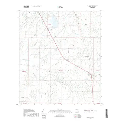
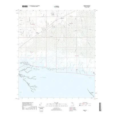
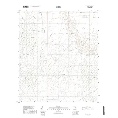
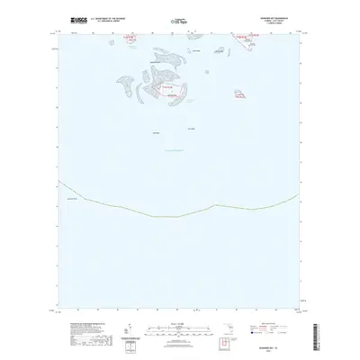
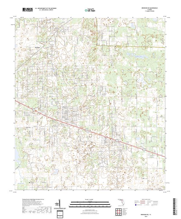
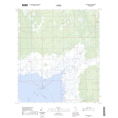
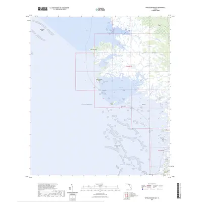
Big Wolf Arbor anchors the southern reaches of this Levy County landscape during the mid-1950s, a period when the terrain remained dominated by extensive wetlands and isolated water bodies. The hydrology of the area is defined by a series of distinct catchments and watercourses, including the north-flowing Magee Branch and the winding Black Prong. The distribution of scattered ponds suggests a limestone-driven topography typical of this part of Florida, where features like Wolf Sink indicate active karst activity and natural drainage points.
Find a feature on this map
13 named features on this map. Tap any name to fly to it.
Don’t see what you’re looking for? This feature index may not catch every label — zoom into the map to look around manually.
Map Details
Editions of this 1957 Bronson SE Map
This is the sole edition of this map. No revisions or reprints were ever made.
Historical Maps of Williston Highlands Through Time
93 maps found
1954 Bronson SW
Levy County, FL
1954 Chiefland SW
Levy County, FL
1954 East Pass
Levy County, FL
1954 Manatee Springs
Levy County, FL
1954 Yankeetown SE
Levy County, FL
1955 Bronson NE
Levy County, FL
1955 Bronson SE
Levy County, FL
1955 Lebanon Station
Levy County, FL
1955 Seahorse Key
Levy County, FL
1955 Sumner
Levy County, FL
1955 Tidewater
Levy County, FL
1955 Waccasassa Bay
Levy County, FL
1955 Withlacoochee Bay
Levy County, FL
1957 Bronson SE
Levy County, FL
1968 Lebanon Station
Levy County, FL
1968 Newberry SW
Levy County, FL
1991 Tidewater
Levy County, FL

1991 Yankeetown SE
Levy County, FL
2012 Bronson NE
Levy County, FL

2012 Bronson SE
Levy County, FL
2012 Bronson SW
Levy County, FL
2012 Chiefland SW
Levy County, FL
2012 East Pass
Levy County, FL
2012 Lebanon Station
Levy County, FL
2012 Manatee Springs
Levy County, FL
2012 Newberry SW
Levy County, FL
2012 Seahorse Key
Levy County, FL
2012 Sumner
Levy County, FL
2012 Tidewater
Levy County, FL
2012 Waccasassa Bay
Levy County, FL
2012 Withlacoochee Bay
Levy County, FL
2012 Yankeetown SE
Levy County, FL
2015 Bronson NE
Levy County, FL
2015 Bronson SE
Levy County, FL
2015 Bronson SW
Levy County, FL
2015 Chiefland SW
Levy County, FL
2015 East Pass
Levy County, FL
2015 Lebanon Station
Levy County, FL
2015 Manatee Springs
Levy County, FL
2015 Newberry SW
Levy County, FL
2015 Seahorse Key
Levy County, FL
2015 Sumner
Levy County, FL
2015 Tidewater
Levy County, FL
2015 Waccasassa Bay
Levy County, FL
2015 Withlacoochee Bay
Levy County, FL
2015 Yankeetown SE
Levy County, FL
2018 Bronson NE
Levy County, FL

2018 Bronson SE
Levy County, FL
2018 Bronson SW
Levy County, FL
2018 Chiefland SW
Levy County, FL
2018 East Pass
Levy County, FL
2018 Lebanon Station
Levy County, FL
2018 Manatee Springs
Levy County, FL
2018 Newberry SW
Levy County, FL
2018 Seahorse Key
Levy County, FL
2018 Sumner
Levy County, FL
2018 Tidewater
Levy County, FL
2018 Waccasassa Bay
Levy County, FL
2018 Withlacoochee Bay
Levy County, FL
2018 Yankeetown SE
Levy County, FL
2021 Bronson NE
Levy County, FL
2021 Bronson SE
Levy County, FL
2021 Bronson SW
Levy County, FL
2021 Chiefland SW
Levy County, FL

2021 East Pass
Levy County, FL
2021 Lebanon Station
Levy County, FL
2021 Manatee Springs
Levy County, FL
2021 Newberry SW
Levy County, FL
2021 Seahorse Key
Levy County, FL

2021 Sumner
Levy County, FL
2021 Tidewater
Levy County, FL
2021 Waccasassa Bay
Levy County, FL
2021 Withlacoochee Bay
Levy County, FL
2021 Yankeetown SE
Levy County, FL
2024 Bronson NE
Levy County, FL
2024 Bronson SE
Levy County, FL
2024 Bronson SW
Levy County, FL
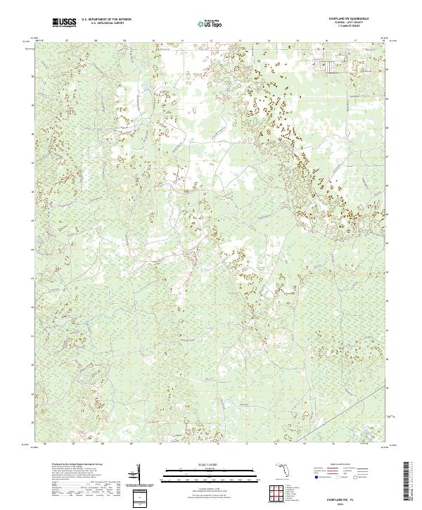
2024 Chiefland SW
Levy County, FL
2024 East Pass
Levy County, FL

2024 Lebanon Station
Levy County, FL
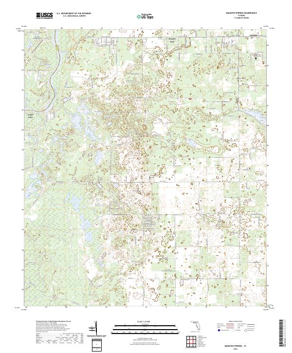
2024 Manatee Springs
Levy County, FL
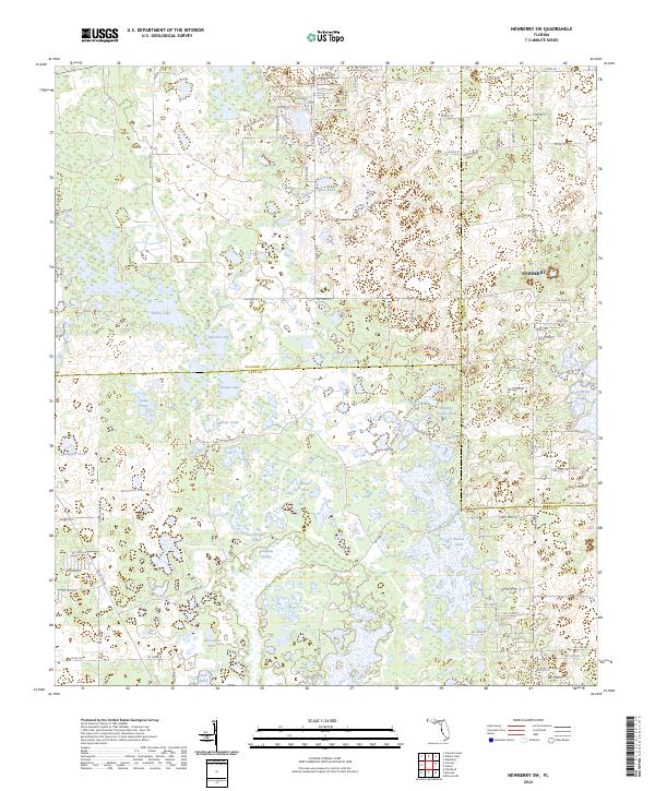
2024 Newberry SW
Levy County, FL
2024 Seahorse Key
Levy County, FL
2024 Sumner
Levy County, FL
2024 Tidewater
Levy County, FL
2024 Waccasassa Bay
Levy County, FL
2024 Withlacoochee Bay
Levy County, FL
2024 Yankeetown SE
Levy County, FL
2025 East Pass
Levy County, FL
2025 Seahorse Key
Levy County, FL
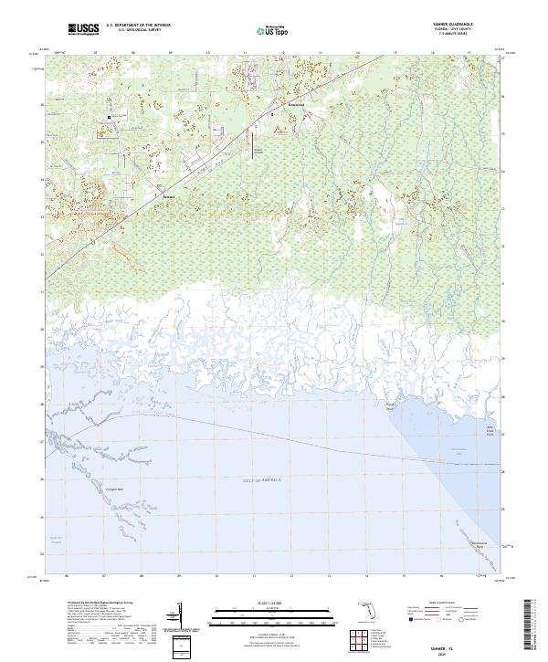
2025 Sumner
Levy County, FL
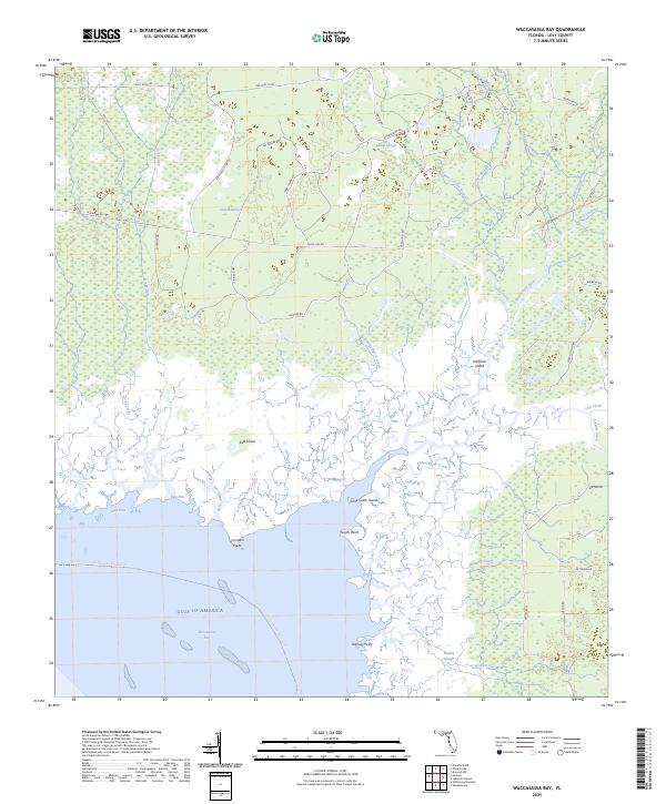
2025 Waccasassa Bay
Levy County, FL
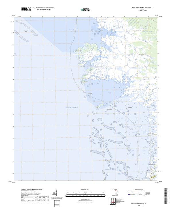
2025 Withlacoochee Bay
Levy County, FL