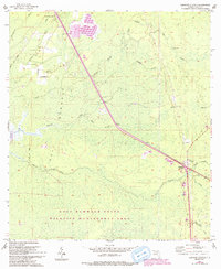
1955 Map of Lebanon Station
USGS Topo · Published 1993About this map
The low-lying wetlands of the Gulf Hammock State Wildlife Management Area dominate this mid-century survey of coastal Levy County. The map documents a landscape defined by its intricate hydrology, where the Waccasassa River and Mule Creek wind through dense hammocks and sloughs toward the Waccasassa Bay State Preserve. Evidence of the region’s timber and river-based history is visible in the placement of several riverside points, including Peeks Landing and Old Plantation Landing, as well as an Old RR Grade cutting through the marsh.
Find a feature on this map
34 named features on this map. Tap any name to fly to it.
Don’t see what you’re looking for? This feature index may not catch every label — zoom into the map to look around manually.
Map Details
Editions of this 1955 Lebanon Station Map
3 editions found
Other maps of this area

1954 · Yankeetown SE
USGS Topo · 1:24,000

1954 · Otter Creek
USGS Topo · 1:24,000

1954 · Bronson SW
USGS Topo · 1:24,000

1954 · Gainesville
USGS Topo · 1:250,000

1955 · Lebanon Station
USGS Topo · 1:24,000

1955 · Withlacoochee Bay
USGS Topo · 1:24,000

1955 · Waccasassa Bay
USGS Topo · 1:24,000

1955 · Yankeetown
USGS Topo · 1:24,000

1955 · Tidewater
USGS Topo · 1:24,000

1955 · Bronson SE
USGS Topo · 1:24,000