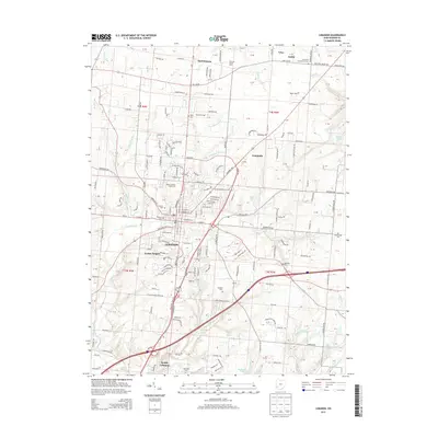
2013 Map of Lebanon
USGS Topo · Published 2013About this map
Lebanon sits at the heart of this Warren County landscape, showing its role as a regional center through the presence of the Warren County Fairgrounds and several historic burial grounds like Pioneer Cem and Lebanon Cem. The surrounding territory is marked by a network of smaller communities including Merrittstown, Genntown, and South Lebanon. The drainage pattern is defined by the numerous runs and creeks that carve through the area, such as Turtle Cr, Mooneys Run, and Irons Run. To the north, the Old Stone Schoolhouse Cem near Dodds hints at the older rural education structure of the county. The map also documents modern commercial landmarks like the Dental Assistant Pro LLC and equestrian interests at Dancing Horse Farm, illustrating the evolution from a strictly agricultural district to a mixed residential and professional landscape.
Find a feature on this map
102 named features on this map. Tap any name to fly to it.
Don’t see what you’re looking for? This feature index may not catch every label — zoom into the map to look around manually.
Map Details
Editions of this 2013 Lebanon Map
This is the sole edition of this map. No revisions or reprints were ever made.
Other maps of this area

1904 · Mason
USGS Topo · 1:62,500

1906 · Mason
USGS Topo · 1:62,500

1908 · Miamisburg
USGS Topo · 1:62,500

1913 · Waynesville
USGS Topo · 1:62,500

1914 · Morrow
USGS Topo · 1:62,500

1915 · Waynesville
USGS Topo · 1:62,500

1916 · Morrow
USGS Topo · 1:62,500

1951 · Franklin
USGS Topo · 1:24,000

1953 · Cincinnati
USGS Topo · 1:250,000

1955 · Monroe
USGS Topo · 1:24,000