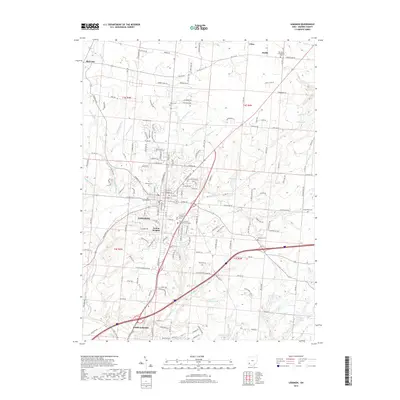
2019 Map of Lebanon
USGS Topo · Published 2019About this map
Lebanon serves as the focal point of this Warren County landscape, showing the dense street grid and civic core centered on the Warren County Courthouse Annex and the Warren County Government Campus. The town's historical depth is reflected in several established burial grounds, including the Pioneer Cem and Lebanon Cem near the town center. The Lebanon and Cincinnati RR tracks underscore the importance of rail transport in connecting this regional hub to larger Ohio markets. To the north and south, the settlements of Red Lion and South Lebanon anchor the periphery, while the terrain transitions into a network of creek valleys. Drainage is dominated by Turtle Cr and its various tributaries like Irons Run and Thompson Run, which define the topography between the rolling uplands and developed residential areas like Avalon Heights.
Find a feature on this map
151 named features on this map. Tap any name to fly to it.
Don’t see what you’re looking for? This feature index may not catch every label — zoom into the map to look around manually.
Map Details
Editions of this 2019 Lebanon Map
This is the sole edition of this map. No revisions or reprints were ever made.
Other maps of this area

1904 · Mason
USGS Topo · 1:62,500

1906 · Mason
USGS Topo · 1:62,500

1908 · Miamisburg
USGS Topo · 1:62,500

1913 · Waynesville
USGS Topo · 1:62,500

1914 · Morrow
USGS Topo · 1:62,500

1915 · Waynesville
USGS Topo · 1:62,500

1916 · Morrow
USGS Topo · 1:62,500

1951 · Franklin
USGS Topo · 1:24,000

1953 · Cincinnati
USGS Topo · 1:250,000

1955 · Monroe
USGS Topo · 1:24,000