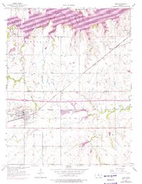
1957 Map of Lebo
USGS Topo · Published 1976About this map
The Atchison Topeka and Santa Fe railroad cuts a sharp diagonal across this portion of the Kansas plains, anchoring the growth of Lebo and smaller sidings like Ridgeton. While much of the landscape is defined by the section lines of the Lincoln, Key West, Arvonia, and Olivet townships, a more ancient division is visible in the Old Indian Boundary that bisects the southern half of the map. This survey also records the expanded footprint of Melvern Lake in the north, showing how the damming of the Marais des Cygnes valley transformed the local geography.
Find a feature on this map
19 named features on this map. Tap any name to fly to it.
Don’t see what you’re looking for? This feature index may not catch every label — zoom into the map to look around manually.
Map Details
Editions of this 1957 Lebo Map
2 editions found
Other maps of this area

1885 · Burlington
USGS Topo · 1:125,000

1889 · Burlingame
USGS Topo · 1:125,000

1894 · Burlingame
USGS Topo · 1:125,000

1894 · Burlington
USGS Topo · 1:125,000

1947 · Lawrence
USGS Topo · 1:250,000

1950 · Lawrence
USGS Topo · 1:250,000

1956 · Lawrence
USGS Topo · 1:250,000

1957 · Lebo
USGS Topo · 1:24,000

1957 · Waverly NW
USGS Topo · 1:24,000
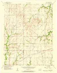
1957 · Lebo NW
USGS Topo · 1:24,000