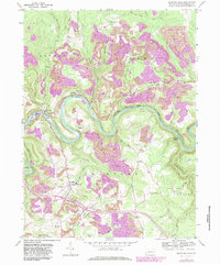
1959 Map of Lecontes Mills
USGS Topo · Published 1983About this map
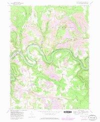
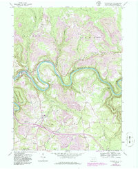
West Branch Susquehanna River carves a dramatic serpentine path through this landscape, defining the industrial and social development of Clearfield County. By the late 1950s, the area shows a complex layers of use, from the traditional agricultural and timber settlements like Lecontes Mills and Gillingham to the heavy industrial footprint of numerous Strip Mines. The Conrail line follows the river's tight bends, passing through the Shawville Tunnel to service the region's energy needs. Local life is anchored by dispersed rural landmarks, including the Township Sch and several country churches like Egypt Ch and Pleasant Valley Ch. The inclusion of a Drive-in Theater and the Airway Beacon near Bishtown reflects mid-century modernizations reaching into these river valleys, while older burial grounds like Shiloh Cem and Murray Cem provide essential data points for genealogical research.
Find a feature on this map
55 named features on this map. Tap any name to fly to it.
Don’t see what you’re looking for? This feature index may not catch every label — zoom into the map to look around manually.
Map Details
Editions of this 1959 Lecontes Mills Map
6 editions found
Other maps of this area

1903 · Houtzdale
USGS Topo · 1:62,500

1905 · Houtzdale
USGS Topo · 1:62,500

1922 · Philipsburg
USGS Topo · 1:62,500

1929 · Karthaus
USGS Topo · 1:62,500

1929 · Clearfield
USGS Topo · 1:48,000

1932 · Clearfield
USGS Topo · 1:62,500

1932 · Karthaus
USGS Topo · 1:62,500

1939 · Philipsburg
USGS Topo · 1:62,500
1944 · Glen Richey
USGS Topo · 1:24,000

1945 · Philipsburg
USGS Topo · 1:62,500