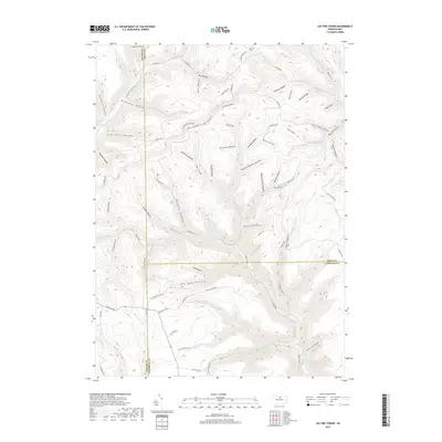
2019 Map of Lee Fire Tower
USGS Topo · Published 2019About this map
Lee Fire Tower overlooks a landscape defined by deeply incised drainages and high ridges at the convergence of Potter, Tioga, and Lycoming counties. This 2019 survey captures a terrain shaped by both natural waterways and human industry, most notably along Kettle Creek and Cushman Branch. The naming of Gas Well Hollow, Former Shanty Hollow, and Clay Mine Rd reflects a history of resource extraction and temporary timber or mining camps. The extensive network of corridors like Francis Leetonia Rd and Pipeline Line Rd demonstrates how the forest has been navigated for utility and forestry. While the heights of Chestnut Ridge dominate the center, named features such as Stony Valley and Big Dam Hollow suggest the specific landmarks known to local hunters and woodsmen who moved through these watersheds.
Find a feature on this map
85 named features on this map. Tap any name to fly to it.
Don’t see what you’re looking for? This feature index may not catch every label — zoom into the map to look around manually.
Map Details
Editions of this 2019 Lee Fire Tower Map
This is the sole edition of this map. No revisions or reprints were ever made.
Other maps of this area

1937 · Waterville
USGS Topo · 1:48,000

1943 · Hyner
USGS Topo · 1:62,500

1943 · Waterville
USGS Topo · 1:62,500

1946 · Young Womans Creek
USGS Topo · 1:24,000

1946 · Tiadaghton
USGS Topo · 1:24,000

1946 · Antrim
USGS Topo · 1:62,500

1946 · Renovo East
USGS Topo · 1:62,500

1946 · Cedar Run
USGS Topo · 1:24,000

1946 · Slate Run
USGS Topo · 1:24,000

1947 · Galeton
USGS Topo · 1:62,500