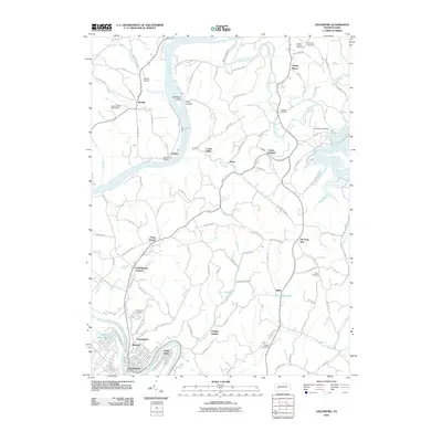
2010 Map of Leechburg
USGS Topo · Published 2010About this map
The Allegheny River and Kiskiminetas River anchor this landscape in western Pennsylvania, where industrial riverfronts meet the rural uplands of Armstrong County. In the southern corner, Leechburg and Hyde Park sit at a sharp bend in the Kiskiminetas, while further north, the Allegheny winds past Nicholson Island and the settlement of McVille. This era is characterized by a network of small, scattered communities like Dime, Georgetown, and Banfield, connected by a complex system of hollows and ridges.
Find a feature on this map
98 named features on this map. Tap any name to fly to it.
Don’t see what you’re looking for? This feature index may not catch every label — zoom into the map to look around manually.
Map Details
Editions of this 2010 Leechburg Map
This is the sole edition of this map. No revisions or reprints were ever made.
Other maps of this area

1900 · Kittanning
USGS Topo · 1:62,500

1901 · Rural Valley
USGS Topo · 1:62,500

1902 · Kittanning
USGS Topo · 1:62,500

1902 · Elders Ridge
USGS Topo · 1:62,500

1903 · Rural Valley
USGS Topo · 1:62,500

1904 · Elders Ridge
USGS Topo · 1:62,500

1907 · Freeport
USGS Topo · 1:62,500

1909 · Freeport
USGS Topo · 1:62,500

1953 · Pittsburgh
USGS Topo · 1:250,000

1953 · New Kensington East
USGS Topo · 1:24,000