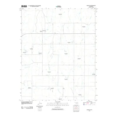
2010 Map of Leedey SW
USGS Topo · Published 2010About this map
Quartermaster Creek and its many tributaries define this Custer County landscape, characterized by an extensive system of flood control and water management structures. The area surrounding the small settlement of Angora is dominated by a dense network of numbered earthen dams, such as Quartermaster Site 12 Dam and Quartermaster Site 14 Dam, which manage runoff across the rolling plains. This infrastructure highlights the region's historical reliance on managed water resources for agriculture and land stability.
Find a feature on this map
29 named features on this map. Tap any name to fly to it.
Don’t see what you’re looking for? This feature index may not catch every label — zoom into the map to look around manually.
Map Details
Editions of this 2010 Leedey SW Map
This is the sole edition of this map. No revisions or reprints were ever made.
Other maps of this area

1955 · Clinton
USGS Topo · 1:250,000

1957 · Clinton
USGS Topo · 1:250,000

1960 · Cheyenne
USGS Topo · 1:62,500

1960 · Hammon
USGS Topo · 1:62,500

1961 · Leedey
USGS Topo · 1:62,500

1965 · Roll NE
USGS Topo · 1:24,000

1966 · Roll SE
USGS Topo · 1:24,000

1984 · Foss Reservoir
USGS Topo · 1:100,000
1987 · Leedey SW
USGS Topo · 1:24,000
1987 · Flying Creek
USGS Topo · 1:24,000