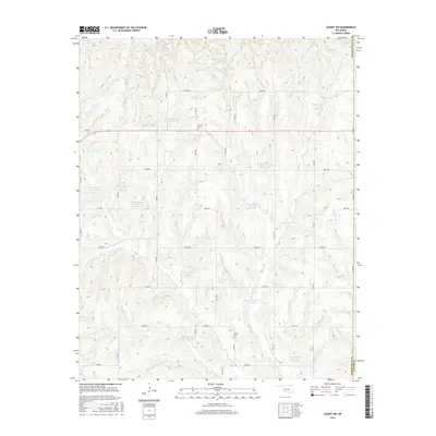
2016 Map of Leedey SW
USGS Topo · Published 2016About this map
Quartermaster Creek and its many tributaries define the hydrology of this rural landscape along the border of Custer and Roger Mills counties. The drainage basin is managed through an extensive network of flood control structures, including Quartermaster Site 1a Reservoir, Quartermaster Site 10 Reservoir, and Quartermaster Site 4 Reservoir. These man-made water bodies follow the winding paths of Hay Creek and Cyclone Creek, creating a highly modified agricultural environment designed to mitigate soil erosion and manage runoff.
Find a feature on this map
44 named features on this map. Tap any name to fly to it.
Don’t see what you’re looking for? This feature index may not catch every label — zoom into the map to look around manually.
Map Details
Editions of this 2016 Leedey SW Map
This is the sole edition of this map. No revisions or reprints were ever made.
Other maps of this area

1955 · Clinton
USGS Topo · 1:250,000

1957 · Clinton
USGS Topo · 1:250,000

1960 · Cheyenne
USGS Topo · 1:62,500

1960 · Hammon
USGS Topo · 1:62,500

1961 · Leedey
USGS Topo · 1:62,500

1965 · Roll NE
USGS Topo · 1:24,000

1966 · Roll SE
USGS Topo · 1:24,000

1984 · Foss Reservoir
USGS Topo · 1:100,000
1987 · Leedey SW
USGS Topo · 1:24,000
1987 · Flying Creek
USGS Topo · 1:24,000