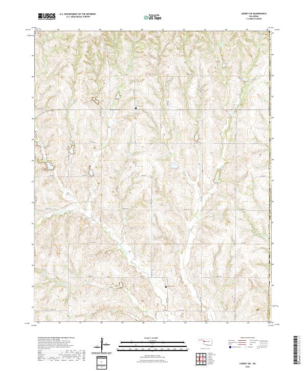
2022 Map of Leedey SW
USGS Topo · Published 2022About this map
Quartermaster Creek and its seasonal tributaries carve a network of drainage across the undulating landscape of eastern Roger Mills County. This section of western Oklahoma retains a deeply rural character, defined by a strictly organized section-line road grid including E0800 Rd and N 2020 Rd. Small local burial sites like Red Star Cem and Dewey Cem serve as quiet markers of the early families who settled these uplands. Along the eastern edge, the Co Line Rd follows the boundary between Roger Mills and Custer counties, illustrating the precision of the Public Land Survey System that shaped the region's development. The map details numerous unnamed farmsteads and rural dwellings connected by a dense web of local routes like E0840 Rd and N1990 Rd.
Find a feature on this map
37 named features on this map. Tap any name to fly to it.
Don’t see what you’re looking for? This feature index may not catch every label — zoom into the map to look around manually.
Map Details
Editions of this 2022 Leedey SW Map
This is the sole edition of this map. No revisions or reprints were ever made.
Other maps of this area

1955 · Clinton
USGS Topo · 1:250,000

1957 · Clinton
USGS Topo · 1:250,000

1960 · Cheyenne
USGS Topo · 1:62,500

1960 · Hammon
USGS Topo · 1:62,500

1961 · Leedey
USGS Topo · 1:62,500

1965 · Roll NE
USGS Topo · 1:24,000

1966 · Roll SE
USGS Topo · 1:24,000

1984 · Foss Reservoir
USGS Topo · 1:100,000
1987 · Leedey SW
USGS Topo · 1:24,000
1987 · Flying Creek
USGS Topo · 1:24,000