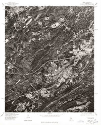
1975 Map of Leeds
USGS Topo · Published 1977About this map
The ridge-and-valley landscape of Jefferson County appears in high-contrast detail in this mid-1970s orthophotoquad. The city of Leeds occupies the central and southeastern portion of the sheet, where residential grids and industrial clearings spread across the valley floors. In the northwestern corner, a portion of Trussville is visible, showing the early suburban development patterns typical of the era. Produced by the U.S. Geological Survey in cooperation with the Soil Conservation Service, this orthophoto uses aerial imagery from 1975 to provide a direct visual record of the land surface. The image reveals the complex intersection of natural topography and human infrastructure, from the winding mountain roads to the broad paths of the regional highway system that connects these Alabama communities.
Find a feature on this map
2 named features on this map. Tap any name to fly to it.
Don’t see what you’re looking for? This feature index may not catch every label — zoom into the map to look around manually.
Map Details
Editions of this 1975 Leeds Map
This is the sole edition of this map. No revisions or reprints were ever made.
Other maps of this area

1889 · Springville
USGS Topo · 1:125,000

1889 · Birmingham
USGS Topo · 1:125,000

1890 · Bessemer
USGS Topo · 1:125,000

1890 · Talladega
USGS Topo · 1:125,000

1892 · Birmingham
USGS Topo · 1:125,000

1892 · Springville
USGS Topo · 1:125,000

1892 · Talladega
USGS Topo · 1:125,000

1892 · Bessemer
USGS Topo · 1:125,000

1895 · Birmingham
USGS Topo · 1:125,000

1905 · Leeds
USGS Topo · 1:62,500