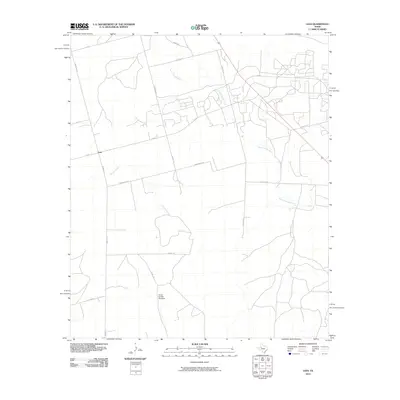
2010 Map of Lees
USGS Topo · Published 2010About this map
Lees remains a focal point in this West Texas landscape, positioned where F-M 461 intersects with the local road network. The terrain is defined by the intermittent flows of the North Concho River and Panther Creek, which cut across the high plains. Ranching and land management infrastructure are evident through named features like the North Cauble Windmill, a critical water source in this arid environment. The map shows a transition in rural access, with long-standing thoroughfares such as Farm Rd 33 and Drumright Rd connecting scattered homesteads and agricultural operations. This 2010 survey illustrates the enduring patterns of Glasscock County settlement, where property lines and naming conventions like Cauble Rd and Phillips Rd reflect family histories and the practicalities of navigating the open country.
Find a feature on this map
19 named features on this map. Tap any name to fly to it.
Don’t see what you’re looking for? This feature index may not catch every label — zoom into the map to look around manually.
Map Details
Editions of this 2010 Lees Map
This is the sole edition of this map. No revisions or reprints were ever made.
Other maps of this area

1941 · Morita
USGS Topo · 1:62,500

1941 · Big Spring South
USGS Topo · 1:62,500

1942 · Big Spring South
USGS Topo · 1:62,500

1949 · Morita
USGS Topo · 1:62,500

1954 · Big Spring
USGS Topo · 1:250,000

1954 · San Angelo
USGS Topo · 1:250,000

1958 · San Angelo
USGS Topo · 1:250,000

1958 · Big Spring
USGS Topo · 1:250,000

1963 · Ballinger Ranch
USGS Topo · 1:24,000

1963 · Garden City NE
USGS Topo · 1:24,000