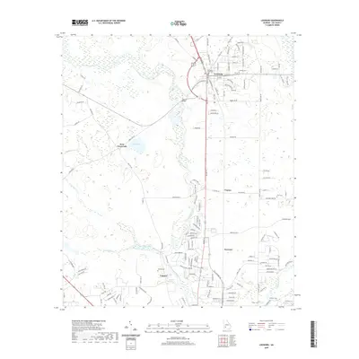
2020 Map of Leesburg
USGS Topo · Published 2020About this map
Kinchafonee Creek and Muckalee Creek define the drainage patterns of this Lee County landscape, winding through a region characterized by scattered settlements and agricultural tracts. The town of Leesburg serves as the central hub, anchored by the Lee County Courthouse and established residential grids like those along Smithville Rd. To the west, the crossroads at Byne Crossroads and the waters of James Pond mark a more rural interior, while the southern reaches feature smaller communities such as Century, Forrester, and Palmyra. For those researching local history or genealogy, the map identifies several burial sites including Leesburg Cem, Lowe Cem, and Palmyra Cem. The presence of Palmyra Springs and numerous smaller watercourses like Rock Hole Cr highlight the reliance on natural water sources that historically shaped the placement of farmsteads and rural dwellings in this part of Georgia.
Find a feature on this map
147 named features on this map. Tap any name to fly to it.
Don’t see what you’re looking for? This feature index may not catch every label — zoom into the map to look around manually.
Map Details
Editions of this 2020 Leesburg Map
This is the sole edition of this map. No revisions or reprints were ever made.
Other maps of this area

1953 · Dothan
USGS Topo · 1:250,000

1954 · Dothan
USGS Topo · 1:250,000

1955 · Dothan
USGS Topo · 1:250,000

1956 · Albany East
USGS Topo · 1:24,000

1956 · Albany West
USGS Topo · 1:24,000

1956 · Sasser
USGS Topo · 1:62,500

1956 · Albany
USGS Topo · 1:62,500

1956 · Leslie
USGS Topo · 1:62,500

1973 · Sasser
USGS Topo · 1:24,000

1973 · Pretoria
USGS Topo · 1:24,000