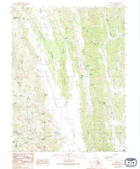
1989 Map of Leesville
USGS Topo · Published 1994About this map
Leesville sits at the eastern edge of Bear Valley, a distinctive landscape of parallel ridges and alluvial flats in the inner Coast Range. The settlement is positioned near the Leesville Gap, where several small valleys converge. This area reflects a long history of cattle ranching and water management, evidenced by numerous named springs such as Adobe Spring, Skinnerville Spring, and Barrel Spring. To the west, the Bear Valley Buttes separate the main valley from Gravelly Valley, while the north is defined by the steep drainage of Little Indian Valley Creek. The presence of Robbers Flat and the small settlement of Gaither to the south suggest a quiet, sparsely populated rural economy centered on the few reliable water sources and flatlands suitable for grazing.
Find a feature on this map
50 named features on this map. Tap any name to fly to it.
Don’t see what you’re looking for? This feature index may not catch every label — zoom into the map to look around manually.
Map Details
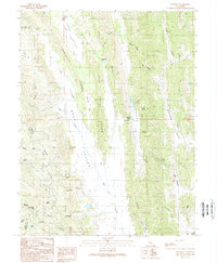
Editions of this 1989 Leesville Map
2 editions found
Other maps of this area

1904 · Sites
USGS Topo · 1:24,000

1905 · Fairview
USGS Topo · 1:24,000

1917 · Sites
USGS Topo · 1:31,680

1920 · Venado
USGS Topo · 1:62,500

1924 · Bartlett Springs
USGS Topo · 1:62,500

1942 · Bartlett Springs
USGS Topo · 1:62,500

1943 · Lodoga
USGS Topo · 1:62,500

1944 · Bartlett Springs
USGS Topo · 1:62,500

1944 · Wilbur Springs
USGS Topo · 1:62,500

1951 · Stonyford
USGS Topo · 1:62,500