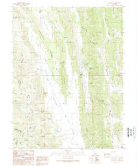
1989 Map of Leesville
USGS Topo · Published 1989About this map
Bear Valley and the Gravelly Buttes dominate this 1980s landscape along the border of Colusa and Lake Counties. The terrain is defined by a series of north-south valleys, including High Valley, Blanchard Valley, and Sawtelle Valley, separated by steep ridges and narrow gaps. At the heart of this network lies the small settlement of Leesville near Leesville Gap, where the local road system converges.
Find a feature on this map
49 named features on this map. Tap any name to fly to it.
Don’t see what you’re looking for? This feature index may not catch every label — zoom into the map to look around manually.
Map Details
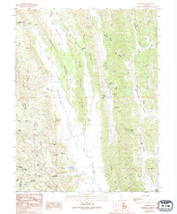
Editions of this 1989 Leesville Map
2 editions found
Other maps of this area

1904 · Sites
USGS Topo · 1:24,000

1905 · Fairview
USGS Topo · 1:24,000

1917 · Sites
USGS Topo · 1:31,680

1920 · Venado
USGS Topo · 1:62,500

1924 · Bartlett Springs
USGS Topo · 1:62,500

1942 · Bartlett Springs
USGS Topo · 1:62,500

1943 · Lodoga
USGS Topo · 1:62,500

1944 · Bartlett Springs
USGS Topo · 1:62,500

1944 · Wilbur Springs
USGS Topo · 1:62,500

1951 · Stonyford
USGS Topo · 1:62,500