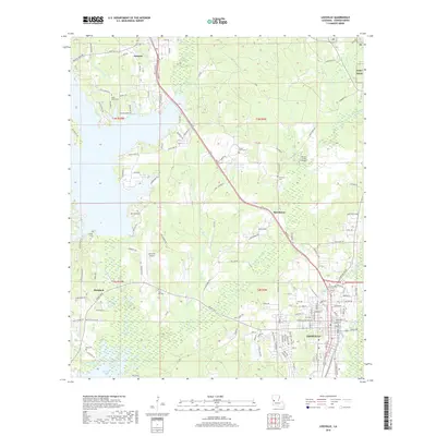
2018 Map of Leesville
USGS Topo · Published 2018About this map
Leesville serves as a significant hub in Central Louisiana, characterized by a detailed street grid and its proximity to the western edge of Fort Polk. The landscape is defined by the expansive waters of Vernon Lake and Anacoco Lake, which dominate the hydrology of the western and central portions of the quadrangle. Transport patterns are clearly marked by the Kansas City Southern railroad line, which runs north-south through Anacoco and Hawthorne, mirroring the primary road corridors that connect these smaller settlements to the parish seat.
Find a feature on this map
154 named features on this map. Tap any name to fly to it.
Don’t see what you’re looking for? This feature index may not catch every label — zoom into the map to look around manually.
Map Details
Editions of this 2018 Leesville Map
This is the sole edition of this map. No revisions or reprints were ever made.
Other maps of this area

1941 · Leesville
USGS Topo · 1:62,500

1941 · Slagle
USGS Topo · 1:62,500

1942 · Florien
USGS Topo · 1:62,500

1942 · Kisatchie
USGS Topo · 1:62,500

1943 · Leesville
USGS Topo · 1:62,500

1943 · Kisatchie
USGS Topo · 1:62,500

1944 · Florien
USGS Topo · 1:62,500

1944 · Slagle
USGS Topo · 1:62,500

1946 · Leesville
USGS Topo · 1:62,500

1948 · Leesville
USGS Topo · 1:62,500