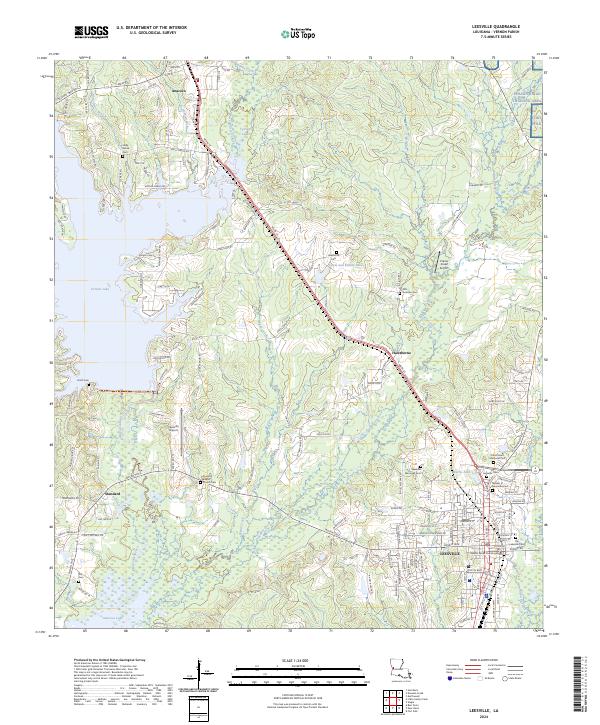
2024 Map of Leesville
USGS Topo · Published 2024About this map
The Vernon Parish Courthouse stands as the center of civic life in Leesville, a region shaped by a complex network of waterways and military installations. The landscape is dominated by the massive Vernon Lake to the west and Anacoco Lake to the south, with Bayou Anacoco and Bayou Castor threading through the piney woods. Military presence is prominent in the northeast, where the Peason Ridge Training Area and portions of Fort Polk occupy the higher ground.
Find a feature on this map
158 named features on this map. Tap any name to fly to it.
Don’t see what you’re looking for? This feature index may not catch every label — zoom into the map to look around manually.
Map Details
Editions of this 2024 Leesville Map
This is the sole edition of this map. No revisions or reprints were ever made.
Other maps of this area

1941 · Leesville
USGS Topo · 1:62,500

1941 · Slagle
USGS Topo · 1:62,500

1942 · Florien
USGS Topo · 1:62,500

1942 · Kisatchie
USGS Topo · 1:62,500

1943 · Leesville
USGS Topo · 1:62,500

1943 · Kisatchie
USGS Topo · 1:62,500

1944 · Florien
USGS Topo · 1:62,500

1944 · Slagle
USGS Topo · 1:62,500

1946 · Leesville
USGS Topo · 1:62,500

1948 · Leesville
USGS Topo · 1:62,500