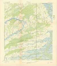
1919 Map of Legareville
USGS Topo · Published 1919About this map
Johns Island and Wadmalaw Island dominate this coastal landscape, separated by the winding path of Church Creek and Bohicket Creek. At this time, the region is characterized by large tracts of woods and brush, with agricultural activity visible along Plowed Ground Road and River Road. The settlement of Legareville sits near the marshes of the Stono River, supported by its own local Legareville School.
Find a feature on this map
28 named features on this map. Tap any name to fly to it.
Don’t see what you’re looking for? This feature index may not catch every label — zoom into the map to look around manually.
Map Details
Editions of this 1919 Legareville Map
2 editions found
Other maps of this area

1918 · Kiawah Island
USGS Topo · 1:21,120

1919 · Johns Island
USGS Topo · 1:21,120

1919 · Wadmelaw Island
USGS Topo · 1:62,500

1919 · Charleston
USGS Topo · 1:21,120

1919 · James Island
USGS Topo · 1:21,120

1919 · Legareville
USGS Topo · 1:21,120

1920 · Ravenels
USGS Topo · 1:62,500

1943 · Legareville
USGS Topo · 1:24,000

1943 · James Island
USGS Topo · 1:24,000

1943 · Kiawah Island
USGS Topo · 1:24,000
Featured Places
- Charleston, SC
- Folly Beach, SC
- Kiawah Island, SC
- Fenwick Crossroads, Johns Island
- Humbert Woods, Johns Island