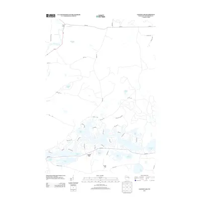
2013 Map of Legend Lake
USGS Topo · Published 2013About this map
The complex shoreline of Legend Lake dominates this Menominee County landscape, revealing an intricate network of residential roads such as Silver Canoe Rd, Red Wing Trl, and Medicine Hat Trl that wind through the timbered peninsulas. This modern survey reflects the area's development as a recreational and residential hub within the Menominee Indian Reservation. Further north, the Wolf River cuts through the terrain at Turtle Rapids and White Rapids, maintaining a more natural character contrasted against the organized settlement patterns to the south.
Find a feature on this map
56 named features on this map. Tap any name to fly to it.
Don’t see what you’re looking for? This feature index may not catch every label — zoom into the map to look around manually.
Map Details
Editions of this 2013 Legend Lake Map
This is the sole edition of this map. No revisions or reprints were ever made.
Other maps of this area

1942 · Breed
USGS Topo · 1:48,000

1952 · Langlade
USGS Topo · 1:48,000

1952 · Mountain
USGS Topo · 1:48,000

1954 · Shawano
USGS Topo · 1:48,000

1954 · Iron Mountain
USGS Topo · 1:250,000

1955 · Green Bay
USGS Topo · 1:250,000

1956 · Gillett
USGS Topo · 1:62,500

1959 · Iron Mountain
USGS Topo · 1:250,000

1964 · Shawano
USGS Topo · 1:62,500
1973 · Fredenberg Lake
USGS Topo · 1:24,000