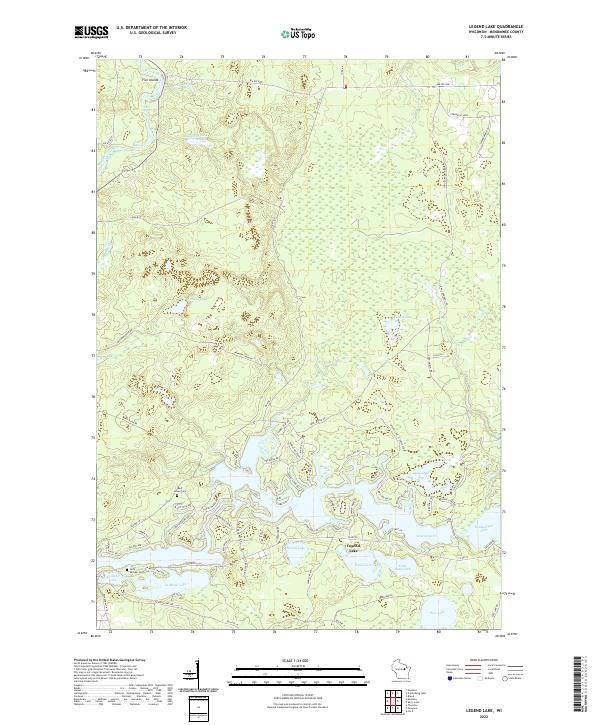
2022 Map of Legend Lake
USGS Topo · Published 2022About this map
Wolf River defines the western reaches of this Menominee County landscape, winding past Turtle Rapids and White Rapids near the cluster of Five Islands. This 2022 survey illustrates the extensive water network of the region, where the large, irregularly shaped Legend Lake serves as a central hub for residential development and recreation. The map provides clear detail for genealogists and local historians, pinpointing burial sites such as Saint Michael Cem near Keshena Lake and Rest Haven Cem to the north. The area is characterized by its transition from the dense wetlands around Rushes Lake and Beauprey Lake to the more structured roads serving the shoreline communities. These include local routes like LaMotte Lake Rd and Long Corduroy Rd, which navigate the complex interfaces between land and water across the Menominee reservation.
Find a feature on this map
78 named features on this map. Tap any name to fly to it.
Don’t see what you’re looking for? This feature index may not catch every label — zoom into the map to look around manually.
Map Details
Editions of this 2022 Legend Lake Map
This is the sole edition of this map. No revisions or reprints were ever made.
Other maps of this area

1942 · Breed
USGS Topo · 1:48,000

1952 · Langlade
USGS Topo · 1:48,000

1952 · Mountain
USGS Topo · 1:48,000

1954 · Shawano
USGS Topo · 1:48,000

1954 · Iron Mountain
USGS Topo · 1:250,000

1955 · Green Bay
USGS Topo · 1:250,000

1956 · Gillett
USGS Topo · 1:62,500

1959 · Iron Mountain
USGS Topo · 1:250,000

1964 · Shawano
USGS Topo · 1:62,500
1973 · Fredenberg Lake
USGS Topo · 1:24,000