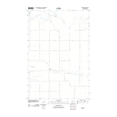
2011 Map of Lehigh
USGS Topo · Published 2011About this map
Lehigh anchors the northern portion of this landscape, situated along the winding course of the Heart River. This early 21st-century mapping shows a rural Stark County environment defined by the transition between river bottomlands and high ground. To the south, Antelope Creek and its tributary Dry Creek meander across the prairie, while the prominent elevation of Dobson Buttes rises in the west. The local infrastructure is captured through a rigid section-line road network, including Lehigh Rd and several numbered avenues, providing access to the river crossings like Shipley Bridge. The map reflects a classic North Dakota ranching and agricultural layout where the topography of the creek beds dictates the movement of cattle and commerce between the plateaus.
Find a feature on this map
27 named features on this map. Tap any name to fly to it.
Don’t see what you’re looking for? This feature index may not catch every label — zoom into the map to look around manually.
Map Details
Editions of this 2011 Lehigh Map
This is the sole edition of this map. No revisions or reprints were ever made.
Other maps of this area

1953 · Dickinson
USGS Topo · 1:250,000

1957 · Dickinson
USGS Topo · 1:250,000

1959 · Dickinson North
USGS Topo · 1:24,000

1959 · Dickinson South
USGS Topo · 1:24,000

1959 · Lehigh
USGS Topo · 1:24,000

1962 · Davis Buttes
USGS Topo · 1:24,000

1973 · Boyle
USGS Topo · 1:24,000

1973 · Lefor NW
USGS Topo · 1:24,000

1973 · Lefor
USGS Topo · 1:24,000

1973 · Gladstone
USGS Topo · 1:24,000