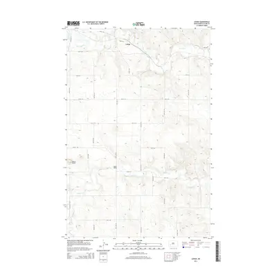
2014 Map of Lehigh
USGS Topo · Published 2014About this map
Lehigh anchors the northern portion of this landscape, situated along the winding course of the Heart River. This North Dakota prairie terrain is defined by a systematic grid of section roads, including Lehigh Rd and Lehigh Dr, which navigate the elevation changes between the river valley and the higher plateaus. To the south, the Antelope Cr meanders across the plains, crossed by the Shipley Bridge. The western edge of the map is marked by the prominent elevations of Dobson Buttes, offering a stark contrast to the surrounding drainage basins. The map illustrates a rural environment where land use is dictated by the water systems and the prominent buttes that rise above the agricultural grid.
Find a feature on this map
22 named features on this map. Tap any name to fly to it.
Don’t see what you’re looking for? This feature index may not catch every label — zoom into the map to look around manually.
Map Details
Editions of this 2014 Lehigh Map
This is the sole edition of this map. No revisions or reprints were ever made.
Other maps of this area

1953 · Dickinson
USGS Topo · 1:250,000

1957 · Dickinson
USGS Topo · 1:250,000

1959 · Dickinson North
USGS Topo · 1:24,000

1959 · Dickinson South
USGS Topo · 1:24,000

1959 · Lehigh
USGS Topo · 1:24,000

1962 · Davis Buttes
USGS Topo · 1:24,000

1973 · Boyle
USGS Topo · 1:24,000

1973 · Lefor NW
USGS Topo · 1:24,000

1973 · Lefor
USGS Topo · 1:24,000

1973 · Gladstone
USGS Topo · 1:24,000