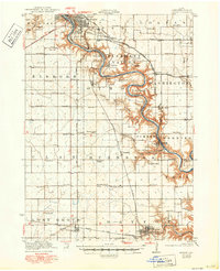
1923 Map of Lehigh
USGS Topo · Published 1949About this map
The Des Moines River carves a deep, winding valley through Webster County, creating a striking contrast between the flat upland prairies and the heavily dissected river bluffs. Along these bends, the industrial character of the early 1920s is evident in settlements like Clayworks, Coalville, and Gypsum, which were tied to the region's rich mineral deposits and brick-making history. The steep terrain of the valley provided a natural landscape for the establishment of Dolliver Memorial State Park, while nearby Wildcat Cave highlights the unique geological features of the river's path.
Find a feature on this map
66 named features on this map. Tap any name to fly to it.
Don’t see what you’re looking for? This feature index may not catch every label — zoom into the map to look around manually.
Map Details
Editions of this 1923 Lehigh Map
3 editions found
Other maps of this area

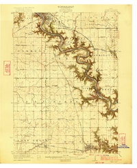
1916 · Boone
USGS Topo · 1:62,500

1923 · Lehigh
USGS Topo · 1:62,500

1923 · Fort Dodge
USGS Topo · 1:62,500

1951 · Ogden
USGS Topo · 1:62,500

1954 · Waterloo
USGS Topo · 1:250,000

1954 · Fort Dodge
USGS Topo · 1:250,000

1955 · Waterloo
USGS Topo · 1:250,000

1957 · Fort Dodge
USGS Topo · 1:250,000

1958 · Fort Dodge
USGS Topo · 1:250,000

1962 · Jefferson
USGS Topo · 1:62,500