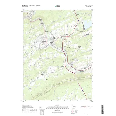
2019 Map of Lehighton
USGS Topo · Published 2019About this map
The Lehigh River carves a deep path through Carbon County, anchoring a landscape of industrial history and rugged geography. This 2019 survey captures the density of the river corridor, where the Lehigh Valley RR and major rail junctions like Packerton Junction and Lizard Creek Junction facilitated the movement of coal and freight. The borough of Lehighton serves as the central hub, surrounded by a constellation of smaller settlements including Weissport, Parryville, and Bowmanstown. To the north, the steep walls of the Lehigh Gorge are preserved within Lehigh Gorge State Park, while the southern boundary follows the ridgeline along the Appalachian National Scenic Trail. Genealogists will find an exceptional density of burial grounds, such as the Saints Peter and Paul Roman Catholic Cem and the New Dinkey Memorial Cem, reflecting the diverse immigrant communities that settled in this valley.
Find a feature on this map
172 named features on this map. Tap any name to fly to it.
Don’t see what you’re looking for? This feature index may not catch every label — zoom into the map to look around manually.
Map Details
Editions of this 2019 Lehighton Map
This is the sole edition of this map. No revisions or reprints were ever made.
Other maps of this area

1889 · Hazleton
USGS Topo · 1:62,500

1891 · Hazleton
USGS Topo · 1:62,500

1893 · Hazleton
USGS Topo · 1:62,500

1902 · Slatington
USGS Topo · 1:62,500

1909 · Hamburg
USGS Topo · 1:62,500

1911 · Hamburg
USGS Topo · 1:62,500

1922 · Mauch Chunk
USGS Topo · 1:62,500

1924 · Mauch Chunk
USGS Topo · 1:62,500

1937 · Allentown West
USGS Topo · 1:48,000

1942 · Allentown West
USGS Topo · 1:62,500