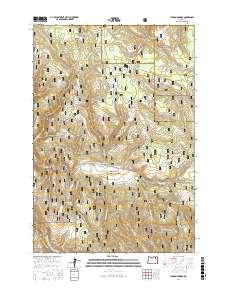
2017 Map of Lehman Springs
USGS Topo · Published 2017About this map
Lehman Springs and the surrounding high country of the Blue Mountains define this landscape, located along the border of Whitman National Forest and Umatilla National Forest. The map detail captures a remote area of Oregon characterized by a dense network of forest development roads, such as Nat For Dev Rd 2110 and Nat For Dev Rd 040, which facilitate movement between high-altitude meadows and creek drainages. Significant landmarks include the expansive Nelson Meadows and French Corral Meadow, reflecting a landscape used for seasonal grazing and timber management.
Find a feature on this map
66 named features on this map. Tap any name to fly to it.
Don’t see what you’re looking for? This feature index may not catch every label — zoom into the map to look around manually.
Map Details
Editions of this 2017 Lehman Springs Map
This is the sole edition of this map. No revisions or reprints were ever made.
Other maps of this area

1953 · Pendleton
USGS Topo · 1:250,000

1956 · Pendleton
USGS Topo · 1:250,000

1967 · Ukiah SE
USGS Topo · 1:24,000

1967 · Tower Mtn
USGS Topo · 1:24,000

1967 · Sullivan Gulch
USGS Topo · 1:24,000

1967 · Lehman Springs
USGS Topo · 1:24,000

1967 · Granite Meadows
USGS Topo · 1:24,000

1967 · Bally Mountain
USGS Topo · 1:24,000

1967 · Pearson Ridge
USGS Topo · 1:24,000

1967 · Owens Butte
USGS Topo · 1:24,000