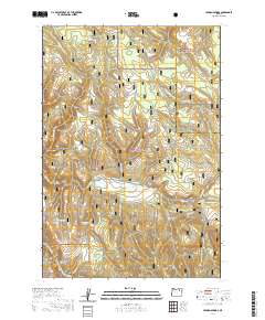
2020 Map of Lehman Springs
USGS Topo · Published 2020About this map
Lehman Springs and Hidaway Springs anchor this high-elevation landscape within the Blue Mountains of Eastern Oregon. The terrain is defined by the intersection of the Whitman National Forest and Umatilla National Forest, split by the county line between Umatilla and Union. Local geography is marked by numerous water sources and meadows, including Nelson Meadows and French Corral Meadow, which suggest a long history of seasonal grazing and forest management. The drainage network is dense, with headwaters for Bear Wallow Cr and Camas Cr carving through the timbered ridges. Transportation is largely limited to forest corridors like Tower Mtn Road 5226 (Snow), reflecting the area's primary use for timber, recreation, and watershed protection. The nomenclature of features like Butcher Knife and Dugout Spring points to the early 20th-century settlers and stockmen who traversed these high-country corridors.
Find a feature on this map
31 named features on this map. Tap any name to fly to it.
Don’t see what you’re looking for? This feature index may not catch every label — zoom into the map to look around manually.
Map Details
Editions of this 2020 Lehman Springs Map
This is the sole edition of this map. No revisions or reprints were ever made.
Other maps of this area

1953 · Pendleton
USGS Topo · 1:250,000

1956 · Pendleton
USGS Topo · 1:250,000

1967 · Ukiah SE
USGS Topo · 1:24,000

1967 · Tower Mtn
USGS Topo · 1:24,000

1967 · Sullivan Gulch
USGS Topo · 1:24,000

1967 · Lehman Springs
USGS Topo · 1:24,000

1967 · Granite Meadows
USGS Topo · 1:24,000

1967 · Bally Mountain
USGS Topo · 1:24,000

1967 · Pearson Ridge
USGS Topo · 1:24,000

1967 · Owens Butte
USGS Topo · 1:24,000