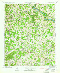
1942 Map of Leicester
USGS Topo · Published 1966About this map
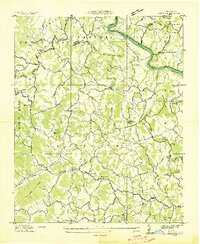
The French Broad River carves a significant course through the northern portion of this 1942 survey, where the Southern railroad follows the water's edge past Volga and Bailey Bend. This rural landscape, straddling the Madison and Buncombe county line, is defined by a dense network of mountain communities and family-named landmarks. The village of Leicester serves as a local hub, anchored by the Leicester School and the Dixie Highway which cuts through the southern valley. Cultural life in the mid-century is evidenced by the high concentration of country churches such as Gudger Chapel, Newfound Church, and Macedonia Church. Topographical relief is prominent, with the Pisgah National Forest boundary reaching toward Grassy Knob, while numerous branches like Sluder Branch and Turkey Creek dictate the placement of farms and cemeteries, including the Sluder Cem.
Find a feature on this map
52 named features on this map. Tap any name to fly to it.
Don’t see what you’re looking for? This feature index may not catch every label — zoom into the map to look around manually.
Map Details
Editions of this 1942 Leicester Map
4 editions found
Other maps of this area

1894 · Asheville
USGS Topo · 1:125,000

1901 · Asheville
USGS Topo · 1:125,000

1935 · Canton
USGS Topo · 1:24,000

1935 · Spring Creek
USGS Topo · 1:24,000

1936 · Marshall
USGS Topo · 1:24,000

1936 · Sandymush
USGS Topo · 1:24,000

1936 · Enka
USGS Topo · 1:24,000

1936 · Weaverville
USGS Topo · 1:24,000

1936 · Mars Hill
USGS Topo · 1:24,000
1936 · Leicester
USGS Topo · 1:24,000