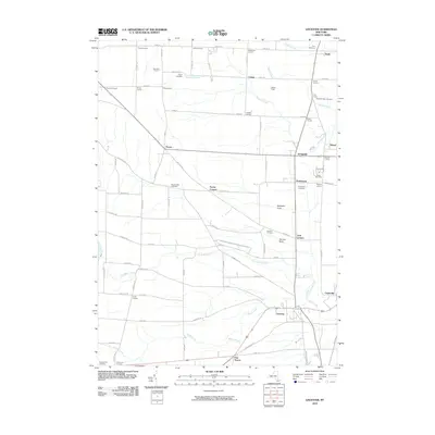
2010 Map of Leicester
USGS Topo · Published 2010About this map
Retsof Salt Mine anchors the eastern edge of this landscape, a significant industrial landmark north of Greigsville. The map reveals a high density of named road intersections, such as Phelps Corners and Roots Corners, reflecting a deeply established rural network where local identity is tied to specific family-named junctions. This pattern continues through the village of Leicester and the settlement of Cuylerville, situated near the winding path of Beards Creek.
Find a feature on this map
66 named features on this map. Tap any name to fly to it.
Don’t see what you’re looking for? This feature index may not catch every label — zoom into the map to look around manually.
Map Details
Editions of this 2010 Leicester Map
This is the sole edition of this map. No revisions or reprints were ever made.
Other maps of this area

1904 · Batavia
USGS Topo · 1:62,500

1904 · Caledonia
USGS Topo · 1:62,500

1905 · Portage
USGS Topo · 1:62,500

1905 · Nunda
USGS Topo · 1:62,500

1943 · Mount Morris
USGS Topo · 1:24,000

1943 · Sonyea
USGS Topo · 1:24,000

1943 · Castile
USGS Topo · 1:24,000
1944 · Sonyea
USGS Topo · 1:31,680
1944 · Geneseo
USGS Topo · 1:31,680
1944 · Mount Morris
USGS Topo · 1:31,680