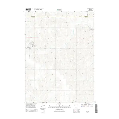
2014 Map of Leigh
USGS Topo · Published 2014About this map
Leigh and the western edge of Clarkson anchor this survey of the agrarian borderlands between Colfax and Stanton counties. The landscape is defined by the winding course of the W Fork Maple Cr, which meanders across the northern and western sections of the map, alongside tributaries like Dry Cr and Taylor Cr. This drainage system created the undulating topography that shapes the local road grid, which includes routes such as Ne-91 and Ne-57.
Find a feature on this map
35 named features on this map. Tap any name to fly to it.
Don’t see what you’re looking for? This feature index may not catch every label — zoom into the map to look around manually.
Map Details
Editions of this 2014 Leigh Map
This is the sole edition of this map. No revisions or reprints were ever made.
Other maps of this area

1955 · Fremont
USGS Topo · 1:250,000

1957 · Fremont
USGS Topo · 1:250,000

1958 · Fremont
USGS Topo · 1:250,000

1963 · Madison SE
USGS Topo · 1:24,000

1966 · Clarkson SW
USGS Topo · 1:24,000

1966 · Humphrey SE
USGS Topo · 1:24,000

1966 · Clarkson
USGS Topo · 1:24,000

1966 · Creston
USGS Topo · 1:24,000
1966 · Stanton SE
USGS Topo · 1:24,000
1966 · Stanton SW
USGS Topo · 1:24,000