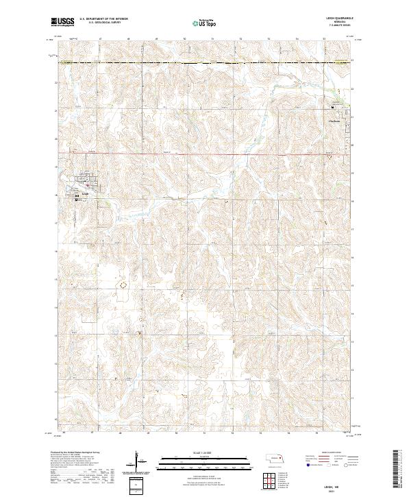
2021 Map of Leigh
USGS Topo · Published 2021About this map
The borderlands of Stanton and Colfax counties are defined by a grid of section roads and the winding paths of the W Fork Maple Cr. This agricultural landscape, documented in 2021, centers on the village of Leigh and the city of Clarkson, two communities tied together by the path of Road W. The survey reveals a high density of historical burial sites concentrated near the settlements, including the Clarkson National Cem and the Zion Lutheran Cem. Local history is anchored by these sites and the grid of residential streets such as Railroad Ave and 3rd St in Leigh. The drainage patterns of Dry Cr and Taylor Cr cut through the uniform section lines, illustrating how the natural topography of the Nebraska plains interacts with the rigid township and range system that organized this prairie farmland into Township 20 North, Range 2 East and its neighbors.
Find a feature on this map
41 named features on this map. Tap any name to fly to it.
Don’t see what you’re looking for? This feature index may not catch every label — zoom into the map to look around manually.
Map Details
Editions of this 2021 Leigh Map
This is the sole edition of this map. No revisions or reprints were ever made.
Other maps of this area

1955 · Fremont
USGS Topo · 1:250,000

1957 · Fremont
USGS Topo · 1:250,000

1958 · Fremont
USGS Topo · 1:250,000

1963 · Madison SE
USGS Topo · 1:24,000

1966 · Clarkson SW
USGS Topo · 1:24,000

1966 · Humphrey SE
USGS Topo · 1:24,000

1966 · Clarkson
USGS Topo · 1:24,000

1966 · Creston
USGS Topo · 1:24,000
1966 · Stanton SE
USGS Topo · 1:24,000
1966 · Stanton SW
USGS Topo · 1:24,000