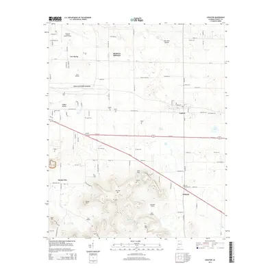
2014 Map of Leighton
USGS Topo · Published 2014About this map
Muscle Shoals and the surrounding agricultural uplands are depicted in detail as they appeared in 2014, showing the transition from industrial transport hubs to rural family homesteads. The terrain is marked by the prominent LaGrange Mtn and Kent Mtn, where the historic LaGrange College was established. Numerous family burial sites, such as Leigh Cem, Adams Cem, and Aycock Cem, are scattered across the landscape, providing essential data for genealogical research. The northern portion of the map is dominated by infrastructure including the Northwest Alabama Regional Airport and the rail-oriented Emco-Listerhill Junction. Natural features like Gnat Pond and the marshy Abernathy Bottom define the drainage patterns of the region, while small settlements like Leighton and Spring Valley serve as local centers for the surrounding farmsteads and hollows.
Find a feature on this map
108 named features on this map. Tap any name to fly to it.
Don’t see what you’re looking for? This feature index may not catch every label — zoom into the map to look around manually.
Map Details
Editions of this 2014 Leighton Map
This is the sole edition of this map. No revisions or reprints were ever made.
Other maps of this area

1914 · Rogersville
USGS Topo · 1:48,000

1914 · Muscle Shoals
USGS Topo · 1:48,000

1916 · Muscle Shoals
USGS Topo · 1:62,500

1916 · Rogersville
USGS Topo · 1:62,500

1924 · Tuscumbia
USGS Topo · 1:48,000

1926 · Tuscumbia
USGS Topo · 1:62,500

1936 · Russellville
USGS Topo · 1:24,000

1936 · Wheeler Dam
USGS Topo · 1:24,000

1936 · Florence
USGS Topo · 1:24,000

1936 · Town Creek
USGS Topo · 1:24,000