
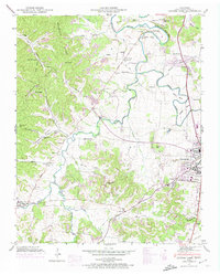
1946 Map of Leipers Fork
USGS Topo · Published 1966About this map
The Harpeth River meanders through this mid-century landscape of Williamson County, winding past the western edge of Franklin. The 1946 topography reveals a region defined by its narrow valleys and ridge systems, most notably Backbone Ridge and the Pea Ridge highlands. For local historians, the map documents the rural infrastructure of the era, from the winding course of the Natchez Trace Parkway to scattered rural nodes like Leipers Fork and Forest Home.
Find a feature on this map
61 named features on this map. Tap any name to fly to it.
Don’t see what you’re looking for? This feature index may not catch every label — zoom into the map to look around manually.
Map Details
Editions of this 1946 Leipers Fork Map
2 editions found
Other maps of this area

1901 · Colombia
USGS Topo · 1:125,000

1903 · Nashville
USGS Topo · 1:125,000

1909 · Franklin
USGS Topo · 1:62,500

1930 · White Bluff
USGS Topo · 1:62,500

1932 · Nashville
USGS Topo · 1:62,500

1933 · White Bluff
USGS Topo · 1:62,500

1936 · Spring Hill
USGS Topo · 1:24,000

1936 · Theta
USGS Topo · 1:24,000

1936 · Bethesda
USGS Topo · 1:24,000

1946 · Bethesda
USGS Topo · 1:24,000