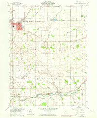
1960 Map of Leipsic
USGS Topo · Published 1974About this map
The town of Leipsic stands as a significant rail hub in this 1960s study, where the Baltimore and Ohio, Detroit Toledo and Ironton, and Norfolk and Western railroads converge. This industrial and transit character is underscored by the Leipsic Junction and localized features like a Claypit and Sewage Disposal plant. To the south, the landscape shifts toward the winding Blanchard River, flanked by rural landmarks including the County Home and the Putnam County Airport.
Find a feature on this map
38 named features on this map. Tap any name to fly to it.
Don’t see what you’re looking for? This feature index may not catch every label — zoom into the map to look around manually.
Map Details
Editions of this 1960 Leipsic Map
2 editions found
Other maps of this area

1906 · Columbus Grove
USGS Topo · 1:62,500

1907 · Bluffton
USGS Topo · 1:62,500

1908 · Columbus Grove
USGS Topo · 1:62,500

1908 · Ottawa
USGS Topo · 1:62,500

1950 · Marion
USGS Topo · 1:250,000

1953 · Fort Wayne
USGS Topo · 1:250,000

1953 · Muncie
USGS Topo · 1:250,000

1956 · Muncie
USGS Topo · 1:250,000

1956 · Fort Wayne
USGS Topo · 1:250,000

1956 · Toledo
USGS Topo · 1:250,000