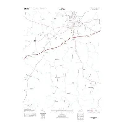
2013 Map of Leitchfield
USGS Topo · Published 2013About this map
Leitchfield serves as the focal point of this regional study, showing the city's modern street grid and its connection to the surrounding Kentucky countryside. The landscape is defined by a dense network of watercourses, including McClure Fork and Taylor Fork, which have shaped the local topography and settlement patterns. To the northwest, the community of Day Cliffs sits near Little Cliffy Cr, while the hamlet of Black Rock occupies the western edge. This 2013 survey provides essential details for researchers, documenting numerous family and community burial grounds such as Kefauver Cem, Hill Cem, and William Cem. The presence of the Grayson County Airport and the Western Kentucky Parkway indicates the area's role as a transportation hub for the county, even as traditional landmarks like Criswell Hollow persist in the rural terrain.
Find a feature on this map
149 named features on this map. Tap any name to fly to it.
Don’t see what you’re looking for? This feature index may not catch every label — zoom into the map to look around manually.
Map Details
Editions of this 2013 Leitchfield Map
This is the sole edition of this map. No revisions or reprints were ever made.
Other maps of this area

1922 · Leitchfield
USGS Topo · 1:48,000

1925 · Cub Run
USGS Topo · 1:62,500

1925 · Leitchfield
USGS Topo · 1:62,500

1932 · Big Clifty
USGS Topo · 1:62,500

1949 · Big Clifty
USGS Topo · 1:24,000

1949 · Big Clifty
USGS Topo · 1:62,500

1953 · Mc Daniels
USGS Topo · 1:24,000

1953 · Ready
USGS Topo · 1:24,000

1953 · Bee Spring
USGS Topo · 1:24,000

1954 · Evansville
USGS Topo · 1:250,000