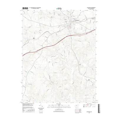
2016 Map of Leitchfield
USGS Topo · Published 2016About this map
Leitchfield serves as the central hub in this modern Grayson County landscape, where the traditional town grid meets the expanding reach of the William Thomason Byway. The map captures a transition between the established city center and the rural periphery, characterized by family-named landmarks and historical burial sites like Hill Cem and Kefauver Cem. To the east, the community of Clarkson borders the winding path of Beaver Dam Cr, while the southwestern reaches are defined by the rugged topography of Day Cliffs and Criswell Hollow. This survey provides a precise record of the regional transportation network, showing the intersection of local routes like Shaw's Station Rd with larger arteries, reflecting the continued importance of the Grayson County Airport to the area's infrastructure.
Find a feature on this map
105 named features on this map. Tap any name to fly to it.
Don’t see what you’re looking for? This feature index may not catch every label — zoom into the map to look around manually.
Map Details
Editions of this 2016 Leitchfield Map
This is the sole edition of this map. No revisions or reprints were ever made.
Other maps of this area

1922 · Leitchfield
USGS Topo · 1:48,000

1925 · Cub Run
USGS Topo · 1:62,500

1925 · Leitchfield
USGS Topo · 1:62,500

1932 · Big Clifty
USGS Topo · 1:62,500

1949 · Big Clifty
USGS Topo · 1:24,000

1949 · Big Clifty
USGS Topo · 1:62,500

1953 · Mc Daniels
USGS Topo · 1:24,000

1953 · Ready
USGS Topo · 1:24,000

1953 · Bee Spring
USGS Topo · 1:24,000

1954 · Evansville
USGS Topo · 1:250,000