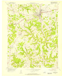
1954 Map of Leitchfield
USGS Topo · Published 1956About this map
Leitchfield serves as the focal point of this mid-century survey, revealing a landscape defined by the intersection of the Illinois Central railroad and a network of rural schoolhouses and churches. The map captures a moment in the mid-1950s when small community centers like Black Rock and Sadler remained distinct, and local education was still decentralized among numerous neighborhood facilities such as Burtle Grove Sch and Rogers Springs Sch. Notable landmarks include the County Home and several Quarries, indicating the local economic and social infrastructure of the era.
Find a feature on this map
44 named features on this map. Tap any name to fly to it.
Don’t see what you’re looking for? This feature index may not catch every label — zoom into the map to look around manually.
Map Details
Editions of this 1954 Leitchfield Map
This is the sole edition of this map. No revisions or reprints were ever made.
Other maps of this area

1922 · Leitchfield
USGS Topo · 1:48,000

1925 · Cub Run
USGS Topo · 1:62,500

1925 · Leitchfield
USGS Topo · 1:62,500

1932 · Big Clifty
USGS Topo · 1:62,500

1949 · Big Clifty
USGS Topo · 1:24,000

1949 · Big Clifty
USGS Topo · 1:62,500

1953 · Mc Daniels
USGS Topo · 1:24,000

1953 · Ready
USGS Topo · 1:24,000

1953 · Bee Spring
USGS Topo · 1:24,000

1954 · Evansville
USGS Topo · 1:250,000